
Design
ENVIRONMENT
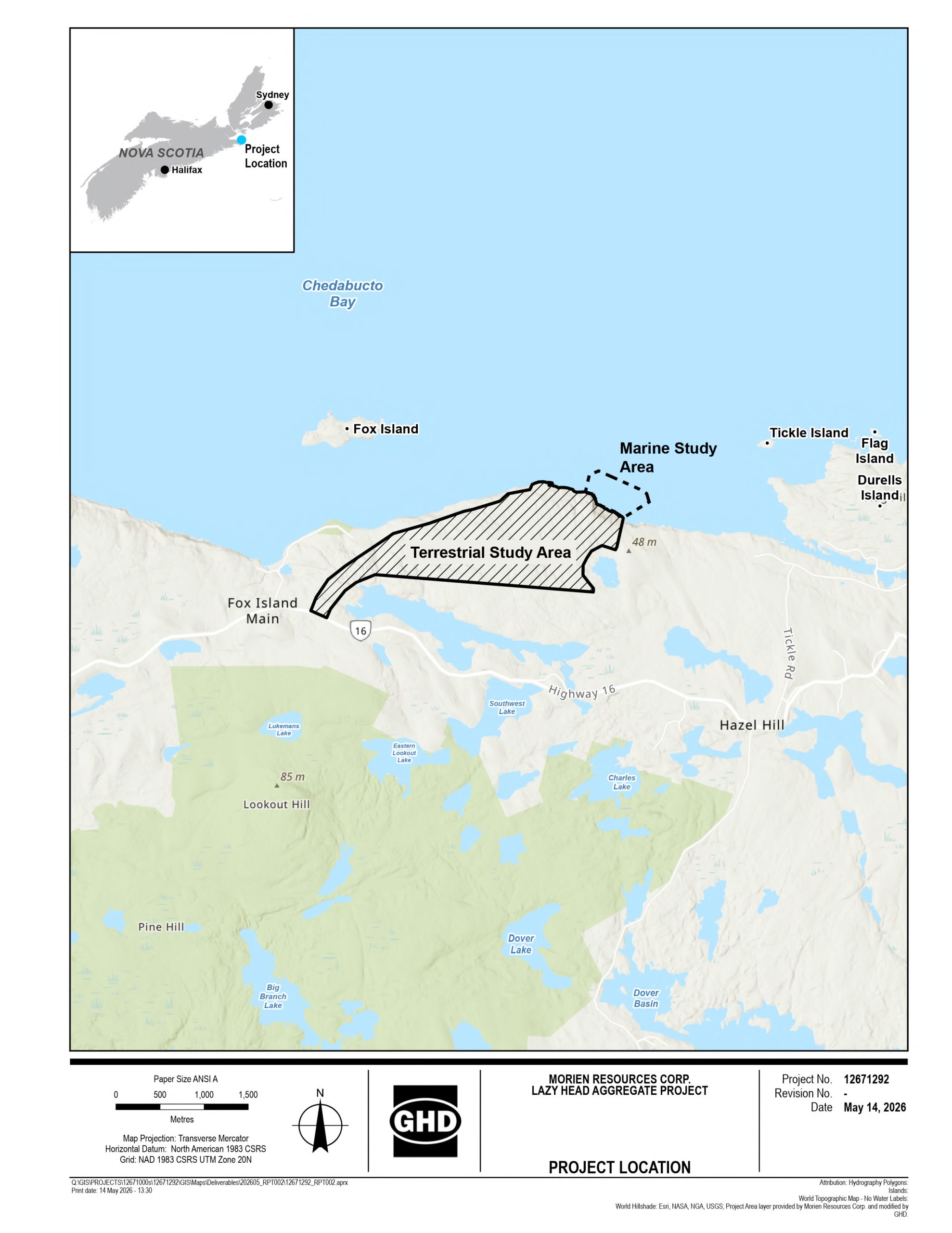
The environmental assessment for Lazy Head is informed by extensive field work and modelling conducted across 2025 and 2026.
Research
Studies Completed
Extensive Fieldwork
The environmental assessment for Lazy Head is informed by extensive field work and modelling conducted across 2025 and 2026. Studies covered:
- Surface water hydrology and water quality
- Groundwater conditions, including drilling, hydraulic testing, and modelling
- Wetland delineation and functional assessment
- Freshwater fish and fish habitat, including environmental DNA (eDNA) sampling
- Marine sediment, benthic communities, and habitat characterization
- Migratory birds (breeding, migration, and nocturnal surveys)
- Terrestrial wildlife, including Mainland Moose
- Vegetation, lichens, and old-growth forest assessment
- Air quality, noise, and lighting baseline conditions
- Archaeological resource impact assessment
These studies form the basis of the Project’s design decisions and the mitigation measures being committed to.
Results
Key Findings
Detailed Reports
A handful of findings are worth highlighting because they directly shape the Project’s environmental profile:
Freshwater Fish Habitat. No fish species at risk were detected in any of the four watercourses on the Project site. The watercourses themselves are intermittent — flowing seasonally rather than year-round.
Marine Environment. No federally listed species at risk were observed within the marine study area. The current marine terminal design does not require dredging.
Wetlands. Twelve small freshwater wetlands totalling 3.7 hectares were identified within the broader project area — approximately 1.6% of the land cover. None were identified as Wetlands of Special Significance.
Old-growth Forest. An old-growth forest assessment was completed within the Project area, including assessment plots and tree coring. The stands did not meet the criteria for old-growth designation, and no protected old-growth forest is present in the Project area.
Archaeological Resources. An Archaeological Resource Impact Assessment was completed across the Project area. No cultural heritage elements were identified. A small coastal section was assessed as having high archaeological potential based on physical landscape characteristics rather than any field findings; Project infrastructure has been laid out to avoid it.
Air, Noise, and Groundwater. Baseline conditions reflect a quiet rural coastal setting. Predictive modelling indicates that operational noise, dust, and groundwater drawdown effects can be managed within applicable regulatory limits with the mitigation measures being committed to.
Mitigation
How We’re Managing Impacts
Careful Planning
The Project’s design has been shaped from the outset by what the field studies found and by what concerns the community has raised. Mitigation falls into four categories.
Design-led Mitigation
- The processing plant will be built into a topographic depression to reduce both visual and acoustic impact.
- Additionally, all crushers and screens will be enclosed in warehouse buildings with spray foam insulation, and all conveyors will be enclosed along their full length, including those running the length of the marine terminal. This contains dust, reduces noise, and prevents material loss to the marine environment during shiploading.
- Process water will operate as a substantially closed-loop system, recirculating within the facility rather than continuously drawing from new sources. All contact water across the site will be collected and treated through a settling pond before any release to the receiving environment. No water wells will be drilled to supply the Project; plant water needs will be met entirely through collected stormwater and recirculated process water
- A 100-metre buffer has been established between Project infrastructure and the Lumsden Lake boundary — a distance that exceeds regulatory requirements and reflects the Project’s commitment to protecting nearby aquatic habitat.
- Twin radial-arm shiploaders allow vessels to be loaded efficiently from a stationary position, reducing the time vessels spend at berth and limiting the duration of any interaction with commercial fishing activity in Chedabucto Bay. Culverts have been incorporated within the rubble mound embankments to allow natural water circulation and mitigate localized sediment accumulation along the structure over time.
- The marine terminal has been designed without the need for in-water dredging, or in-water blasting.
- Refuelling, provisioning, and waste management for visiting vessels will be handled off-site by a contracted third party rather than at the marine terminal itself, eliminating those activities from the immediate marine environment.
Community-protective Measures
- A complaint response process will commit the Project to acknowledging and responding to community concerns within 48 hours, documenting the issue and its resolution, and reporting complaints and resolutions to the Community Liaison Committee at its regular meetings.
- Blasting will not occur on weekends or statutory holidays, or between 6:00 PM and 8:00 AM.
- Before any blasting, structural surveys will be conducted on all buildings within 800 metres of the blast site, in accordance with provincial pre-blast survey procedures. These surveys document existing structural conditions and provide a baseline for any future concerns.
- Settling ponds will be designed to accommodate a 1-in-100-year flood event, with capacity informed by historical data and projected climate change impacts.
- Refuelling will not occur within 30 metres of any waterbody or wetland.
- All on-site fuel storage will be double-walled or fitted with secondary containment, with engineered spill prevention systems. Refuelling will take place on a reinforced concrete or lined containment pad designed to direct any spills to a central collection point. Spill kits will be located at all fuelling and storage stations.
- During marine terminal construction, underwater noise will be continuously monitored. Construction will halt immediately if noise exceeds thresholds set in consultation with DFO.
Water Management
- Process water will operate as a substantially closed-loop system, recirculating water within the facility rather than continuously drawing from new sources.
- All contact water will be collected and treated through a settling pond before any release to the receiving environment.
- The Project will not draw water from groundwater wells.
Wildlife & Habitat Protections
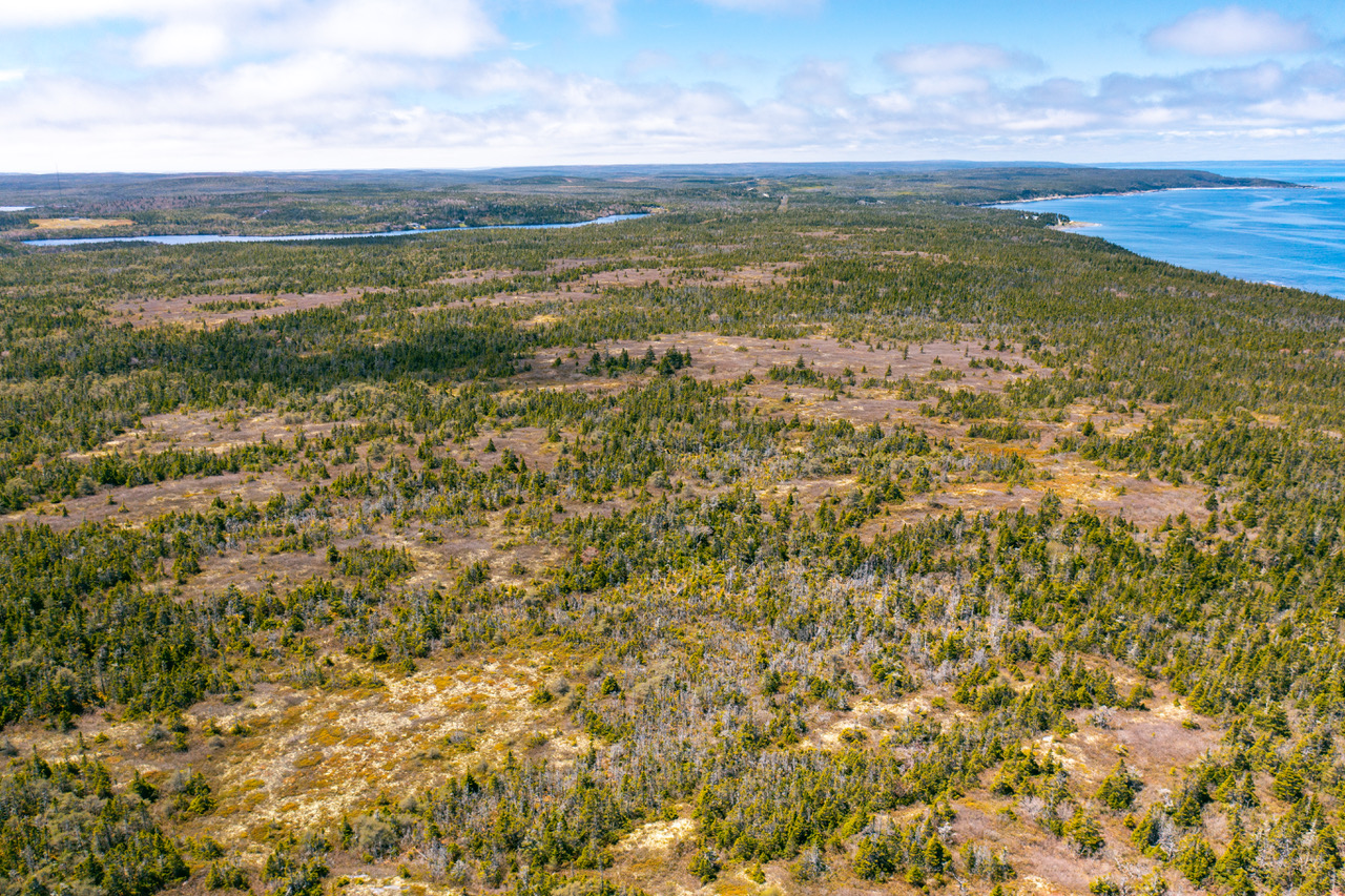
- Vegetation clearing will be planned around the migratory bird nesting season where practicable.
- A 100 metre buffer has been established between Project infrastructure and the Lumsden Lake boundary — a distance that exceeds regulatory requirements.